We’re counting down to the longest land border between two countries with this top 12 list. Many countries around the world are landlocked and share boundaries with one or more neighbors. Countries like China and Russia have the most neighbors and land borders extending thousands of kilometers.
In contrast, other nations like the Vatican – which are so small – have boundaries that don’t even go into double digits. On the other hand, Brazil touches almost every South American nation, barring Ecuador and Chile. The extensive border area is 16,145 kilometers long. That’s more than ten thousand miles!
Some countries’ boundaries with their neighbors are lengthy and cover such varied terrain. As a result, keeping a close watch on these areas is a Herculean task for the security forces that patrol them. This list compiled the longest continuous borders, so you may see a couple of countries mentioned more than once. Well, without further ado, let’s find out where the longest land border is.
Afghanistan – Pakistan 2,430 km (1,510 mi)
12
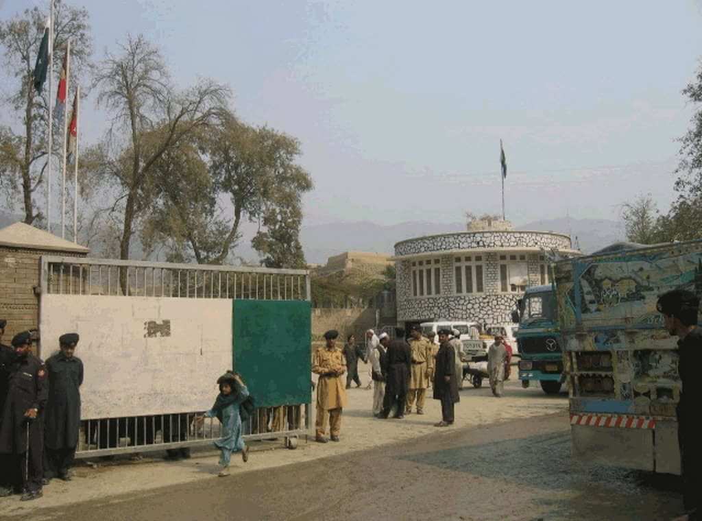
We begin our countdown to the longest land border between two countries with the border area between Afghanistan and Pakistan. As you may know by now, it’s a highly dangerous border region. It was demarcated in 1893 by the Durand Line, which runs for 2,430 km (1,510 mi).
Though the Durand line is internationally accepted as the western border of Pakistan, Afghanistan refuses to acknowledge it as the international border between the two countries. As a result, there is very little government control in the region leading to unchecked or uncontrolled movement across the border.
Pakistan is in the midst of constructing a border barrier to restrict the infiltration of militants across this border. On the other hand, Afghanistan is trying to shake off its war-torn image and restore its past glory. With that said, people still visit this part of the world. Wondering why? Read our list of top things to do in Afghanistan to find out.


India – Pakistan 2,912 km (1,809 mi)
11
Ever since it came into existence in 1947, the boundary between India and Pakistan has seen countless conflicts. The 2,912-km (1,809-mi) boundary between the two nations begins from the Line of Control in Kashmir in the north. And it continues to Zero Point between the Indian state of Gujarat and the Sindh province of Pakistan.
Being a highly-contested area, Kashmir makes this boundary not just one of the longest land borders in the world but also among the most dangerous. This infamous border is visible from space at night because of the 150,000 floodlights installed by India. You can see the fantastic view in the image below!


Mexico – the United States 3,141 km (1,952 mi)
10
One of the most porous borders of the world is the Mexico-United States border. It extends for 3,141 km (1,952 mi). This busiest boundary of the world has recently been the subject of much controversy. No thanks to the wall and deportation of thousands of illegal immigrants back to Mexico.
But let’s put the controversy behind us and discuss how significant this land border is. It sees over 350 million legal crossings annually. At the Tijuana border, approximately 50,000 vehicles and 25,000 pedestrians use this entry daily. Such statistics! Many of them are travelers entering and leaving both countries.


China – India 3,380 km (2,100 mi)
9
The Sino-India border is referred to as the Line of Actual Control (LAC). And it includes the western sector of the border region as well as the McMahon Line in the east.
Certain parts of the 3,380-km (2,100 mi)-long border have been the subject of much dispute. This dispute mostly occurs at Aksai Chin and the state of Arunachal Pradesh in India. China claims the latter as its own. In 2013, a three-week standoff between the troops of the two countries. This resulted in both nations signing a border defense cooperation agreement.


Bolivia – Brazil 3,400 km (2,100 mi)
8
The 3,400-km(2,100-mi)-long border between Bolivia and Brazil crosses a variety of terrains. It passes through barren deserts, forests, and urban areas. The boundary begins at Pantanal. And it ends in the Amazon rainforest. From both of its furthest points, it passes through Corumba, Mato Grosso do Sul, and Assis Brasil in Acre.
The first border treaty between the two countries was signed in 1867. However, it was the subject of much dispute in later years because of Acre. This region was mistakenly demarcated as a part of Bolivia. The dispute was finally settled in 1903 with the Treaty of Petropolis, in which Bolivia ceded Acre to Brazil.


Mongolia – Russia 3,485 km (2,165 mi)
7
Much of Mongolia’s 3,485-km(2,165-mi)-long border with Russia was established by the Treaty of Kyakhta in 1727. However, the modern border was shaped in 1911. During the Mongolian Revolution that year, the tiny state of Tuva separated from Mongolia. Consequently, it finally became an independent country in 1921. Then, Tuva was eventually annexed into the Soviet Union in 1944, forming the current boundary.
The endpoints of the eastern and western parts of the border are ‘tripoints’ shared with China. There are ten official crossing points along the border. Two of which are railway crossings.


Russia – China 3,645 km (2,265 mi)
6
In total, Russia and China share the longest land border between two countries. However, the Sino-Russian border consists of two non-contiguous sections. They are the eastern section (which is much longer) and the shorter western section.
The eastern border begins at the east China-Mongolia-Russia tripoint. And it ends at the Tumen River. On the contrary, the west border between Xinjiang in China and the Altai Republic of Russia is less than 100 km (62 mi). And it mainly covers the snow-covered region of the Altai Mountains. In total, this boundary extends over 3,645 km (2,265 mi).


India – Bangladesh 4,053 km (2,518 mi)
5
This highly porous boundary between Bangladesh and India spans a length of 4,053 km (2,518 mi). It has seen numerous infiltrations of people into the Indian territory from Bangladesh.
The boundary runs along the boundaries of five Indian states northeast of the country and six divisions of Bangladesh. Certain areas of the border have fences. However, due to the geographical barriers, it has been impossible to erect boundary fences everywhere.


China – Mongolia 4,677 km (2,906 mi)
4
Mongolia shares an extensive boundary with both China and Russia. But its boundary with China is much longer at 4,677 km (2,906 mi). That whopping number makes it the longest land border between two countries in Asia.
This boundary touches both the Mongolia-Russia border and the China-Russia border. The eastern end encompasses a part of the Gobi Desert. This fact alone makes it one of the unique land borders. Its western end is located just 55 km from the Kazakhstan-Russia border.
Unfortunately, this boundary is infamous for sex trafficking. This mostly occurs in the industrial sites and mines near the border, including the Tavan Tolgoi coal deposits.


Argentina – Chile 5,300 km (3,300 mi)
3
The boundary between Argentina and Chile is the longest land border between two countries in South America at 5,300 km (3,300 mi). And it’s, of course, one of the longest land borders in the world. About 150 km (93 mi) of it spans the Tierra del Fuego area, where you’ll find a resort town of Ushuaia.
Although the land area of Chile is much smaller than Argentina, its length along the southwestern part of South America has resulted in this extensive boundary. The Boundary Treaty of 1881, signed between the two countries, laid the groundwork for demarcating the borders for almost all of Chile’s and Argentina’s shared borders.


Kazakhstan – Russia 6,846 km (4,254 mi)
2
The international boundary between Kazakhstan and Russia is one of the longest land borders in the world. It spans a distance of 6,846 km (4,254 mi). The existing border took shape in 1930 but only became an international boundary when the USSR was dissolved in 1991. This posed some problems for the railway line as one branch of the Trans-Siberian Railway had to go through two border crossings. In 2017, the two countries agreed to allow transit trains without border control.


Canada – United States 8,893 km (5,526 mi)
1
The border between Canada and the United States is officially known as the International Boundary. The extensive boundary also includes the boundary that Canada shares with Alaska. A total of thirteen US states and eight Canadian provinces and territories are located along the border. Spanning 8,893 km (5,526 mi), it’s definitely the longest land border between two countries.
Throughout history, the border has undergone several changes, with various treaties being signed. However, on April 11, 1908, the Treaty of 1908 was signed between the United Kingdom and the United States. This treaty is about surveying and delimiting the boundary between the two North American countries through the St. Lawrence River and Great Lakes.


Just So You Know About The Longest Land Borders Between Two Countries
- China has the distinction of being the country with the most land borders. The country has 16 unique land neighbors and 22,147 km (13,762 mi) of land borders. But these borders are not one continuous border. That’s why they don’t sit on top of our list as the longest land border between two countries.
- Trains crossing between Mongolia and China need to change their wheels at the town of Erlian. This is due to the railway tracks in China being much narrower than in Mongolia.
- Brazil touches almost every South American nation, except for Ecuador and Chile. In total, the extensive border area is 16,145 kilometers (more than 10,000 miles).
- Belgium and Netherlands share the most separate segments of international border length. The municipality of Baarle-Hertog in Baarle, a town in the southern Netherlands, has a group of 22 Belgian enclaves within the Netherlands. While on the Dutch side, the municipality of Baarle-Nassau has eight counter-enclaves.
- Botswana shares the shortest land border length with Zambia. The 155 m (509 ft) boundary is located near Kazungula.
